Cerro Quitasol Hike in Medellin: The Highest Viewpoint
Some of the links in this article are affiliate links. I may earn a commission by clicking these links, which helps me create more free travel content for everyone. For more information, check out my cookie policy.
I want to start off by saying I underestimated this hike. I knew it would be tough but I didn’t think it was this hard. I’m not trying to shy you away from this hike because Cerro Quitasol is definitely worth doing. Not only do you get the best views of Medellin but it is pretty rewarding once you’re at the peak.
According to Google Translate, Cerro Quitasol means sun-shading hill. Let me be the first to tell you that on the way up, there was no shade. This wasn’t what made it hard, though. The incline of this hike is grueling and straight up. We always felt like we were almost there, then realized that wasn’t the case.
We saw some campgrounds on the way up. If you have camping gear then sleeping up here for sunrise would be an amazing experience. In this guide, I will be giving the full details of the hike as well as some tips.

Cerro Quitasol Hike Details
- Distance: This is a 6.7-mile point-to-point trail. This depends slightly on which path you take. We followed this wikiloc trail but deviated a little from this which added an extra mile.
- Duration: It took us 7 hours to hike it but that was with multiple stops and a long lunch. 6 hours seems to be the average.
- Difficulty: This hike isn’t on Alltrails but I rate it as difficult. Many other reviews I have read are in agreement. Being in good physical shape is a huge plus on this hike.
- Incline: The elevation gain is around 3800 feet or close to 1200 meters. The trail is straight for the majority of the time until you reach the peak.
- Hiking Guide: A guide is not needed for this hike and is easily accessible by the public.
I highly suggest that you download wikiloc and follow it for this trail. You can follow the path we took here.
Places to Stay: Best Hostels in Medellin

How to get to Cerro Quitasol Trailhead
By far, the easiest way to the trailhead to start the Cerro Quitasol hike is by taking the metro line A to Niquia. Here, you will get off and walk about 25 minutes to the North. Once you start climbing up sets of stairs through a neighborhood, you will know that you’re getting close. This will cost you around $3000 COP each way.
If you want, you can probably take a taxi when you leave the station, but it could be difficult to tell them exactly where you want to go. The Cerro Quitasol trailhead is actually in the town of Bello, a suburb of Medellin.
You will know that you’re getting close to the trailhead when the street stops and the path upward turns into rock and clay. Below will be a map guiding you to the trailhead from the Niquia Metro Station.
The cost of travel in Colombia and so is the metro in Medellin. This is fantastic as it helps you to see as much as possible of this amazing city!
Related Post: 9 Amazing Hikes in Medellin
Other Hikes in Medellin You Would Love:
- Ancestral Trail (Parque Arvi)
- Cerro Tres Cruces
- Cerro El Volador
- Salto del Angel
- Piedra del Peñol (day trip)
This is just a few of the many unique hikes in Colombia that you should add to your itinerary!
My Experience Hiking Cerro Quitasol in Bello (Medellin)
When I was researching this hike, I knew there would be a lot of elevation gain, so I knew it was going to be hard. We messed up by not bringing enough water. I suggest bringing at least two liters. Thankfully, I had my gray water bottle and was able to fill it at some of the streams along the downward portion.
When you arrive at the trailhead to Cerro Quitasol you will immediately start to hike straight up. The terrain is very interesting. It is filled with large rocks and slippery clay. We were in Medellin during April and May so there was a lot of rain.
After only a few minutes you will begin to have some amazing views of the town below.


Two Different Paths
About 10 minutes after seeing the cross you will come across a section that you think you’re supposed to hike up. Instead, the path starts to take a left-hand turn. The wikiloc trail we were following kept going straight uphill instead of taking that left.
I’m sure you can go past the wired fence but we decided to hook the left and see where it took us. Beginning on this path you start to see some trailblazers. The colors that we began to follow were red and white.
This section added close to another mile but thankfully it was all flat ground. The trail then takes a right-hand turn and you begin your ascent once again.


The Main Incline
Once the flat path starts to curve to the right, you will be headed straight up for a couple more hours at least. This section is the hardest part of the hike. Most of it will be all in the sun. We passed some workers along the way that were working on the trail. I’m not sure why they cut off the other path and made this one but it was fine.
You will know that you’re getting to your first section of the flat when you start seeing stairs on the side of the hill. This trail will end up connecting with the original trail around this area.


The trail begins to flatten out but is filled with larger boulders. It wasn’t an ideal break but we’d take it. Not too much longer and the trail will begin to incline again. This time changing terrains often. You will be led through some shade in a pine forest. Keep following the red and white trailblazers.
Once you get to the part of the fence blocking you, you have to go through it. Thankfully there was enough room and wasn’t too tight of a squeeze. The next part becomes the most scenic of the whole hike and will be walking on some smaller ridgelines.
The vegetation will become thicker and the trail will be harder to follow. This is how you know you’re getting close to the peak.


The Peak and the Descent
You will know you made it to the top when you pass a gated area under the trees. Another 150 feet up you will see a white arrow on the tree. Follow it as this is the path I recommend taking. You can go back down the same way but that wouldn’t be much fun on the knees. Plus the way back is all shaded.
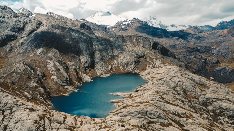
The views from the peak of Cerro Quitasol are amazing. It’s crazy to think how many hikes there are around such a huge city like Medellin.
You will be in the thick woods for the majority of the descent down. The path is usually pretty easy to follow besides some areas. That’s why the trail on wikiloc is so helpful.
After around an hour into your descent down, you will reach a cobblestoned road. This is part of a special park that is special to this area. Al Camino Ancestral Corrales is the name of this area. You will follow this cobblestone road for the majority of your way to the end of the trail.


Other Popular Activities Around Medellin
Medellin is growing in popularity weekly. Everyone I have talked to that has been here having loved it and so far, I do as well. Some of the popular activities here include visiting Communa 13 tour. Communa 13 used to be one of the most dangerous parts of any city in the world and now it is completely redone with graffiti and art. If you are down for a little bit more of an adventure, then visiting the famous El Penol Rock in Guatape is a must when coming to Colombia.
Final Thoughts on Cerro Quitasol Hike in Bello (Medellin)
Cerro Quitasol was an amazing hike and one of my favorites so far in Colombia. Do not underestimate it though. It is still totally worth it to hike it even halfway up because you will have great views the entire time. If you start early enough then you will be fine. Seeing the city from this high up was breathtaking. We kept looking down at where we started and that is what kept motivating us to move forward.
Overall I highly recommend hiking Cerro Quitasol. The main tip of mine is to bring enough water because you will need it.