Grayson Highlands Backpacking: Hiking to Mt Rogers
Some of the links in this article are affiliate links. I may earn a commission by clicking these links, which helps me create more free travel content for everyone. For more information, check out my cookie policy.
Grayson Highlands State Park is located in South Western Virginia. This park is famous for its beautiful mountain skyline, filled with peaks and valleys (even better in the autumn season), and wild ponies! Mt Rogers, which is the highest peak in Virginia, is just outside the park in Jefferson National Forest and is only a day hike away. Grayson Highlands loop hike should be on every backpacker’s bucket list!
We decided to do this 2-3 day loop starting in Grayson Highlands, moving into the Jefferson National Forest, and then back into Grayson Highlands State Park. If you are just going to Grayson Highlands for the day and would like a map before you get there, you can download one here.

Grayson Highlands Loop Hike Details
Where is Grayson Highlands Located?
Grayson Highlands State Park is located in South Eastern Virginia, right on the border of North Carolina and Tennessee. There is no other park like it in Virginia. Grayson Highlands is tremendous for backpacking and seeing wildlife.
Located inside the park is the highest peak in Virginia, Mount Rogers.
I did this hike during the same year as Bearfence Mountain and Stony Man. This was earlier in my career backpacking and I absolutely loved it as a beginner.
Directions to Grayson Highlands State Park
The park is on U.S. 58 halfway between Damascus and Independence. Before you do the Grayson Highlands loop hike, you will need to reserve a parking spot and you can do that here. When you first arrive at the backpackers’ lot in Grayson Highlands, you will go to a box by the trailhead. Here you will look for a paper with your name on it, fill out the sheet, and place the parking pass inside your car. After this, you can begin your hike by going to the left trailhead for Massie Gap. Continue through a short portion of the forest and then onto an open field.

Water Sources During Backpacking Grayson Highlands
There are water sources throughout the Grayson Highlands loop hike and at the shelters. At Thomas Knob Shelter, there is a path behind the actual shelter building, that leads you down the hill to the water source. We stayed at Wise Shelter as well and you will pass by one of the rivers right before you get there. Make sure you bring a water filter so you won’t get sick. We used the Sawyer that fits right onto your water bottle.

My Suggested Hiking Gear


Hike Day 1
This path will then lead to a fence that I believe is there to keep the ponies, seen later, from wandering too far. Through this fence starts the Rhododendron Trail, which you will follow before getting on the Appalachian Trail. While on this trail you will follow blue trailblazers but you shouldn’t have to rely on these because it is a fairly easy path to follow. It was a beautiful day out and we had to stop multiple times to take in all of the scenery.


Keep following the path for not too much longer and you will come across a pole with directions to multiple areas and sites. Our goal for Day 1 was to get to the Thomas Knob Shelter for the night. The directions you will see on the pole will state that Thomas Knob Shelter is three more miles along the Appalachian Trail Southbound. Not too much further past this pole, you will see another and you will want to take a left here and then follow the white trailblazers as you are now on the Appalachian Trail.
Other Hikes in Virginia You’d Love:


You may be wondering where and how often you get to see ponies on this loop. We were wondering the same thing until right after this section. Now we can’t guarantee any specific location will always have them roaming around but once you see a gathering of people, you will know. They are constantly eating most of the time and this helps keep some of the vegetation in check. We got to the top of a hill and there they were. After we took plenty of photos of them, we continued on to a fence that is the barrier between Grayson Highlands State Park and Jefferson National Forest.


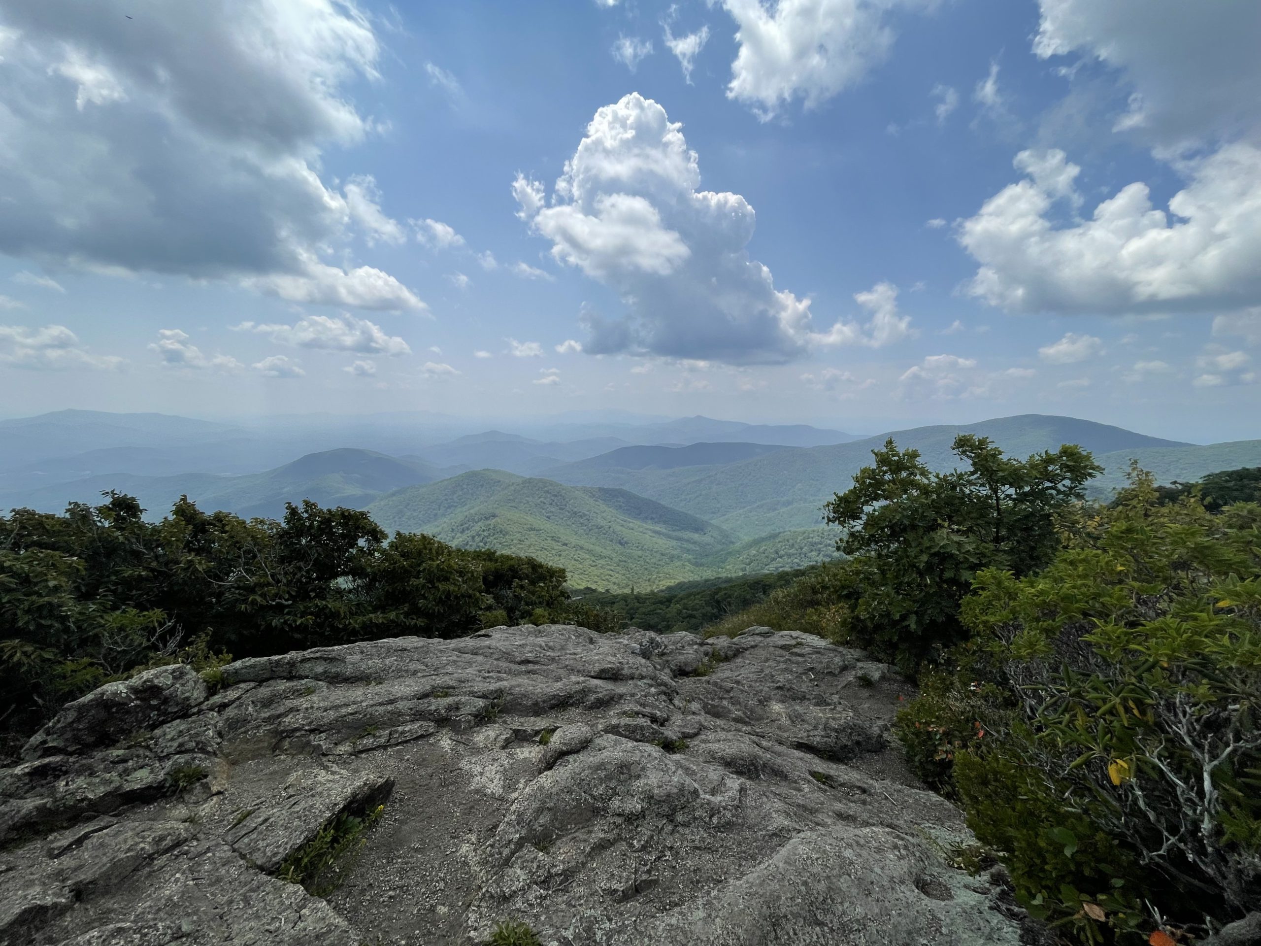
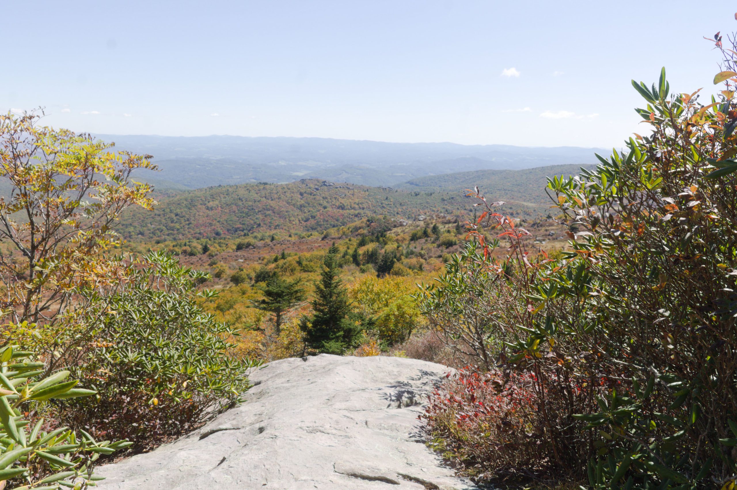
The scenery throughout this first day of hiking was absolutely breathtaking. As you keep following the white blazers past this gate, you will eventually get to an area where it looks like two distinct paths. We were about to follow the one straight ahead if it wasn’t for a group of individuals who suggested we take the path to the right and we are glad we did! At times it felt like we were on a totally different hike through a mountain range and the colors throughout blew us away.

Keep following the white blazers and in 2-3 miles, you will find yourself at the Thomas Knob Shelter. Along this path, there will be many areas that are great for stopping and eating lunch with a view. There is nothing more I like than food and a view! We decided to wait until we got to the shelter to eat lunch and no decision is the wrong one.


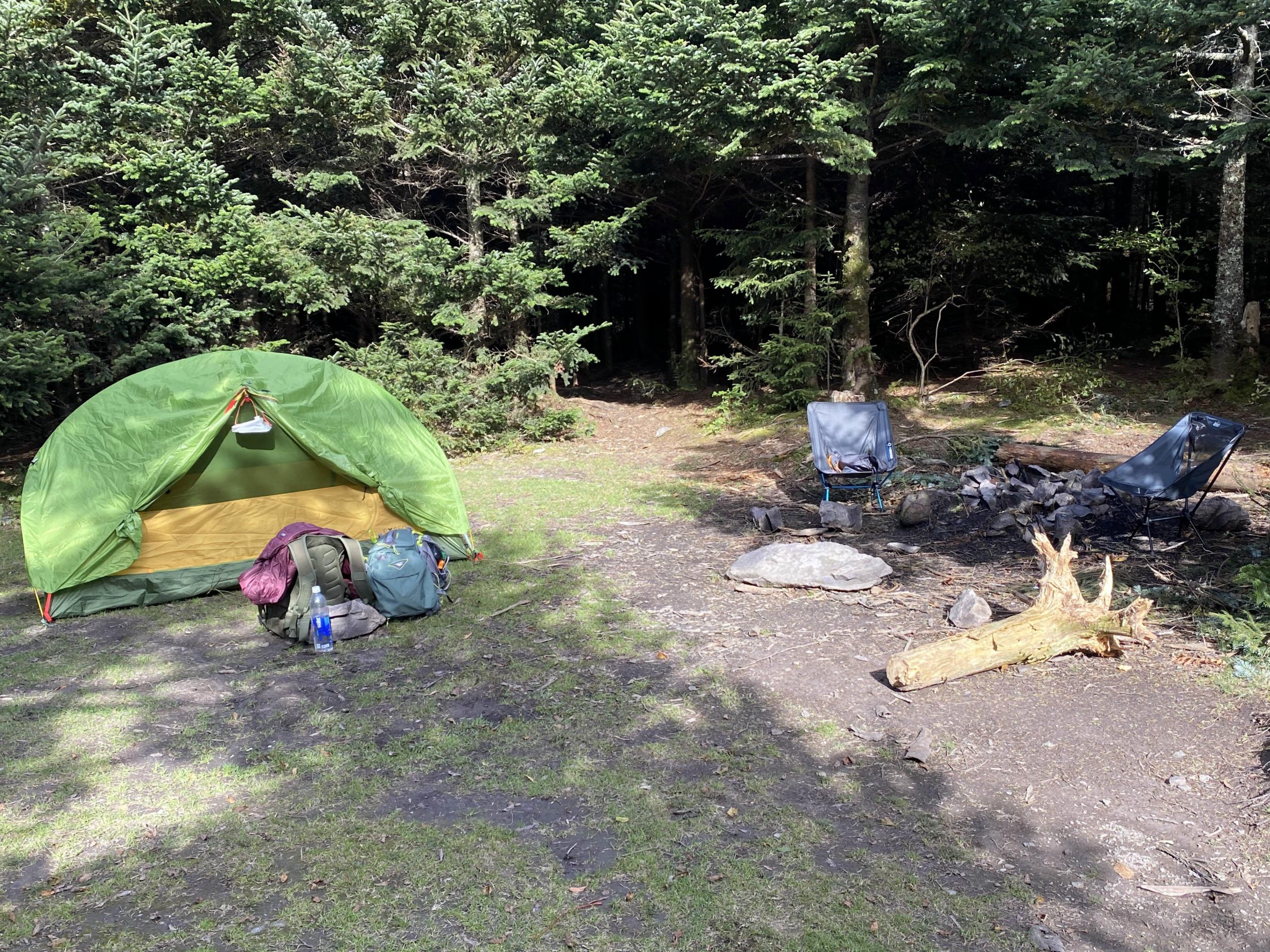
Grayson Highlands Campground
We stayed at the camp once we got there and did Mt. Rogers the following day. I would suggest if you arrive around the time we did (2 pm), then you may want to go and do the short hike to Mt. Rogers on day 1 after you find a camping spot. This will save around an hour or more and is a short hike away from Thomas Knob Shelter.
Hike Day 2
This was the longest day of the three by far. In total, we hiked around 11 miles on day two. The early portion of this day was mostly in the dense forest. There wasn’t much to see as far as views go besides nature at its finest. Keep following the white blazers, as you will still be on the Appalachian Trail until you get to the sign pointing towards route 603 or the Mt. Rodgers Trail.


Keep along the trail for VA 603 by following the blue blazers. The trail doesn’t change too much as far as scenery but the feeling of being immersed in the forest is like no other. After staying on this trail for a couple of miles you will see a sign for Lewis Fork Spur Trail. This trail will have you cut across this section of the forest and will be in some ways a shortcut to getting to the day two campground (Wise Shelter) sooner.


The trail for Lewis Fork Spur isn’t the easiest to follow, especially at first. The leaves and dead trees covered up a lot of the trail but it was still clear enough as to where we should be going. We felt all alone on this trail and didn’t run into another person until 30 or 40 minutes into it. It was easy to tell that this wasn’t the most popular path but we enjoyed this feeling. Everything could be heard such as squirrels chasing each other or water flowing down a stream. Once you see another sign about Lewis Fork Trail, stay on this path for another 45 minutes to an hour, until you get to a gate. It took us a little bit longer because the ground was extremely muddy and we couldn’t take an absolutely straight path.


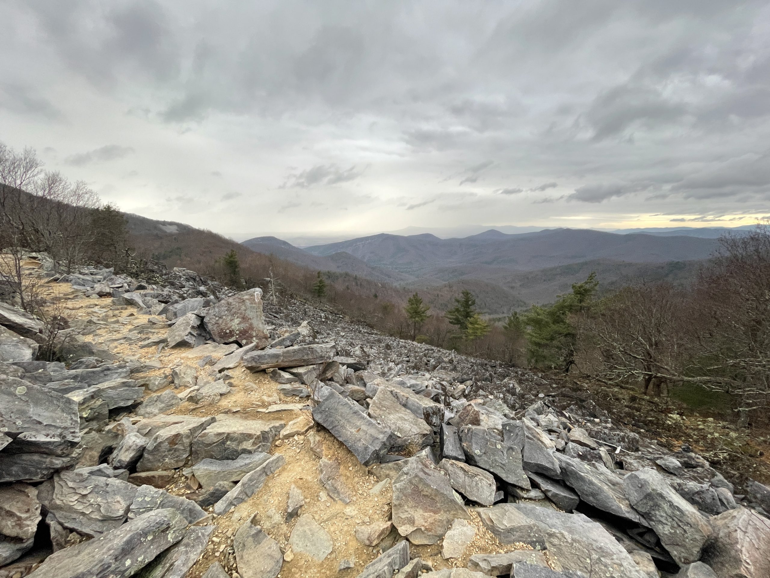
The trail ends and it will lead to the top of a mountain. We saw more ponies here and then kept walking to check out the views. This is where we started to see most of the groups again and they suggested we walk down towards Scales campground to then be a short hike away from Wise Shelter. When you get to the top of the hill, take a sharp left at the sign. The route toward Scales was full of peaks and valleys and we couldn’t help but stop and appreciate it all. Going in Autumn was one of our best ideas as the foliage was some of the best I’ve seen in Virginia. The trail was hard on the feet, especially after hiking nearly seven miles already but we pressed onwards.


After following this path for two miles you will start to descend down a hill and in the background will be the Scales campground. It is easy to spot because it is a car camping area with a fence around it. Begin your trek along the VA Highlands trail and then onto the Wilson Creek trail. The last trail you will need to get on is the Appalachian Trail and this will lead you right to Wise Shelter.


Hike Day 3
After we enjoyed the night at Wise Shelter, cooking up some epic meals (ramen all day baby), we woke up and started the two-mile hike back to the parking lot around 8 am. This was the shortest day by far, with the trek being around 2 miles back to the backpackers’ lot in Grayson Highlands State Park. Follow the Appalachian Trail (white blazers) until you get to an open field on what feels like a mossy damp hill. Follow the Appalachian Spur Trail (blue blazers) straight back to the parking lot and then you are all done!


Thank you for reading my guide on the Grayson Highlands loop hike! This was our first time backpacking for multiple days in the woods and it is safe to say that I am now addicted. We will be planning more trips like this soon!